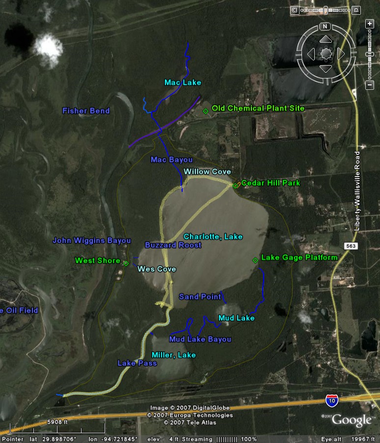
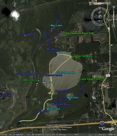
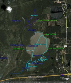
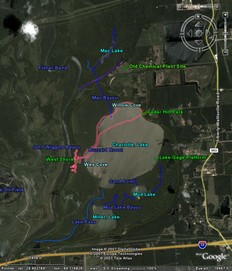
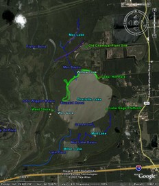
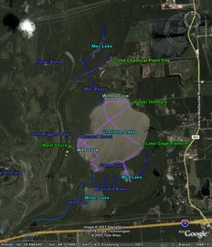
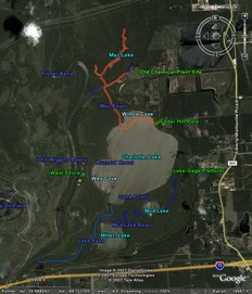
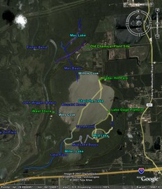
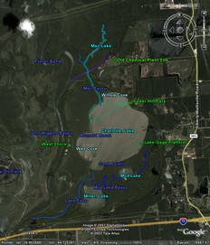
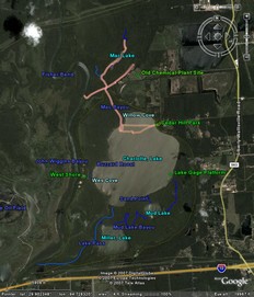
Lake Charlotte Trip Reports
Note that the weather summaries are from a nearby weather station in Mont Belview,
and they cover the extremes for the day. Unless mentioned otherwise these
trips have all occupied about a 4 hour portion of the afternoon, mostly Sundays.
The weather I experienced was generally the high temperature and low humidity reported.
The wind reported is the high for the day and is close to what I experienced.
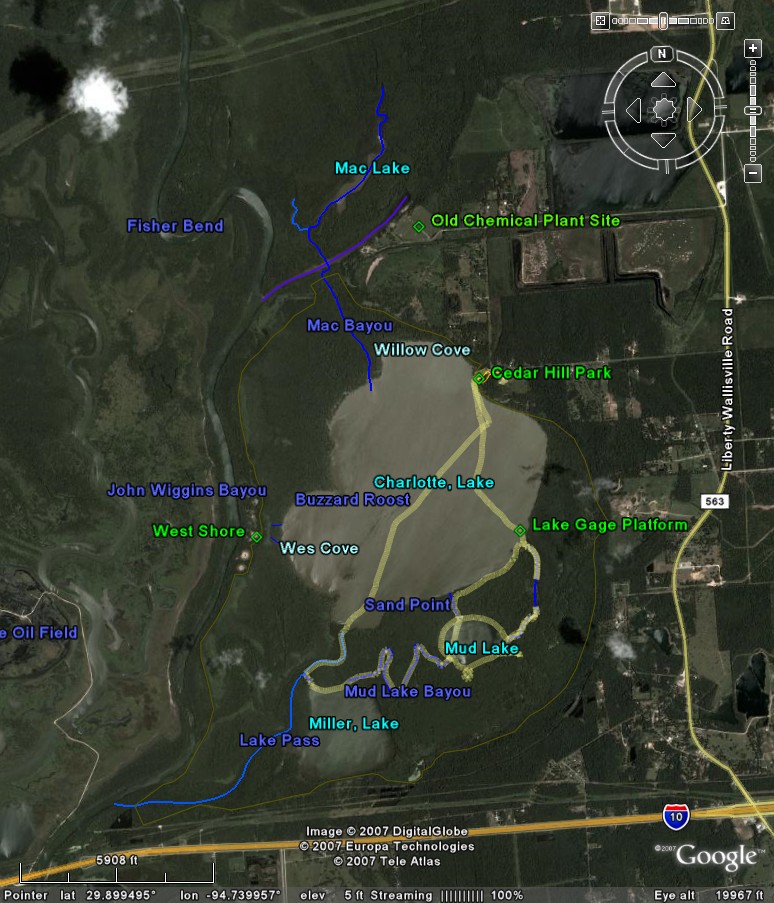
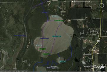
January 7, 2007 - Lake Pass
Gage Level: 11 Feet
Weather Summary for the Day:
47 to 68 degrees Fahrenheit
40% to 98% Humidity
NW Wind 8 mph gusting to 11 mph
This was my first visit to Lake Charlotte. The Gage Height was about 11 feet. Apparently
below levels of about 7 (certainly below 6) feet the lake will be mostly unnavigable
mud. I had a really good time at Lake Charlotte. I initially attempted to put-in
at the I-10 bridge over the Trinity River, but access was closed for maintenance
(good thing, it later turned-out), so instead I went to the Cedar Hill Park at the
northeast corner of the lake, off of Lake Charlotte Road. The put-in there was one
of the nicest I've encountered anywhere, from a grassy rise next to the lake (an
old native american shell midden), just a short distance from where I parked my
car on the edge of the park road, adjacent to a picnic area. Solid ground, with
no difficulty getting the canoe to the water or myself into the canoe, very nice,
and even a restroom off a little loop just inside the park entrance. The lake is
nearly completely bounded by cypress marsh. I initially paddled straight across
the lake to Buzzard Roost, the nearest of the two "islands" on the lake, though
in this case there was no sign of solid ground due to the high water, still it provided
a nice break from the wind and waves. Next I crossed to Bird Island, the other "island"
(same story) to the south of the lake, then began to search for Lake Pass immediately
south and east of the island. Eventually it became clear that the channel was further
to the east, so I paddled around a bend in the shoreline and came upon the entrance
to the channel without any difficulty. I entered the channel and proceeded along
it towards the Trinity a couple of miles to the southwest. There was no solid ground
visible along the channel until I got to within about a tenth of a mile of the Trinity
river, at which point a small channel opened towards a small lake to the south of
the channel, bordered by high solid ground to the east. At this point the current
through Lake Pass had grown so strong that I had a difficult time making the turn
into the side channel, and felt that it was bordering on dangerous due to the narrowness
of the pass, and I decided that it would be safest to turn around and head back
before the current became worse, or dumped me into a dangerously flood-swollen Trinity.
I breaked for a snack, then headed back. Re-entering the Lake Pass channel was challenging,
both in terms of simply turning the canoe 90 degrees to head up-channel, and because
the current was so strong that I had difficulty making much headway against it.
Eventually I shifted off to the side of the channel where the current was lighter,
and made better progress. Understand that my canoe (a Wenonah Prism, 16'6") can
typically cruise at about 4 mph, with bursts to over 5 mph, a fairly fast canoe;
I had to work pretty hard at this point to make even a little progress upstream
against the current, so be cautious near the lower end of the channel when the lake
level is high. Upstream of this point the water in the channel gradually spreads
out into surrounding marsh, so that there is very little current as little as half
a mile further up-channel. Eventually I re-entered Lake Charlotte and found rather
a lot of heavy wind and waves to cope with, so I cut straight into the wind to the
northwest (making about 2 1/2 mph against the wind), pausing briefly to rest at
the nearer island, and eventually arrived at the west side of the lake and entered
amongst the shelter of the cypress marsh adjacent to the lake, then proceeded to
make my way back to the put-in by following along the western and northern edge
of the lake while staying in the sheltered marsh area. This was actually some of
the most fun I've had in a canoe, as I was paddling at a pretty good clip with little
wind while slaloming amonst the cypress trees. Highly recommended! I crossed the
mouth of the northern channel feeding from the Trinity and encountered a fair amount
of current which shoved me a ways back into the lake, then I re-entered the cypress
edge for a short time before striking-out across a small segment of the lake directly
to the put-in at the Park. Altogether a very nice trip. It took me about 4 hours
roundtrip from the park to just shy of the Trinity and back. In future I would be
inclined to spend less time crossing the lake and more time amongst the cypress
trees or down in Lake Pass. I was there in mid-winter, when everything was grey
and brown, and I'm sure it will all be particularly attractive at other times of
the year when everything is green. Additionally there are a couple of other lakes
adjacent to Lake Pass which ought to be worth exploring.
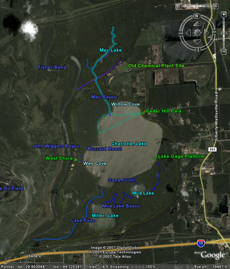
January 21, 2007 - Mud Lake & Miller Lake
Gage Level: 12.7 Feet
Weather Summary for the Day:
47 to 67 degrees Fahrenheit
52% to 98% Humidity
N Wind 4 mph gusting to 6 mph
Put-in at Cedar Hill Park, Gage at ~12.7 feet, paddled SSE to Lake Gage Platform,
where I activated the GPS to get a position for that site. Proceeded along lake
shore, then bushwacked to Mud Lake. Circumnavigated shore of Mud Lake clockwise,
identifying inflow and outflow channels, then exited lake through Mud Lake Bayou
(which was long and twisting, but fairly easy to follow until near Miller Lake).
Note that entrance to Mud Lake Bayou may be difficult to find from Miller Lake.
Proceeded along west shore of Miller Lake, seeking a channel to Lake Pass, however
the likely sites were choked with Hyacinths, so I bushwacked to the Channel at marker
C. Proceeded north through Lake Pass, pausing to note the Lake Pass end of an apparent
channel (marker D) to Miller Lake. Eventually returned to Lake Charlotte and paddled
back to Cedar Hill Park (maintaining 4.5 to 5 mph all the way, clearly the max feasible).
Note that highway noise is fairly substantial at Miller Lake, somewhat less so at
Mud Lake. Mud Lake is otherwise a nice "personal" sized little lake, very nice.
Lake Miller is worth seeing once, but not worth a lot of attention due to the highway
noise.
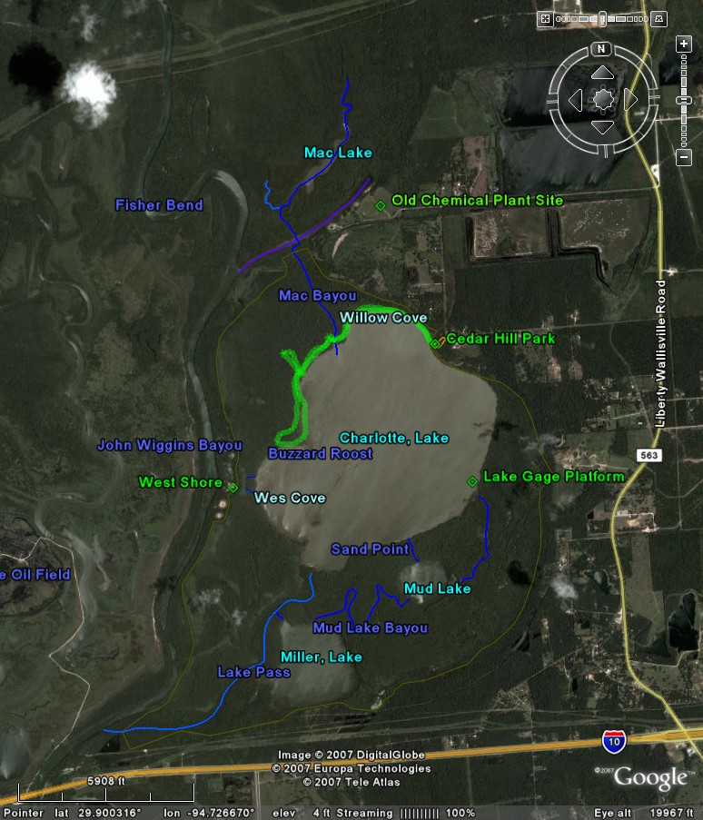
January 28, 2007 - Deep West Marsh
Gage Level: 12.2 Feet
Weather Summary for the Day:
39 to 61 degrees Fahrenheit
31% to 89% Humidity
NNW Wind 8 mph gusting to 10 mph
January 28, 2007: [GPS virtually essential for this trip] Lake level was about 12.2
feet. The objective this trip was to visit the anomalous sandy-looking splotches
visible in Google Earth along the border between Lake Charlotte and the Trinity
River. I stumbled upon some red ribbon markers tied to trees near the point where
I had decided to try cutting through the cypress marsh westward to this region,
and followed through the cypress to where it opened-up into an open marsh. Proceeded
further west into more cypress marsh and came within site of solid ground. I made
an initial landfall at a fairly marshy spot, wandered south and located a better
spot, then moved the canoe to that spot and set-out to explore on foot. The sandy
splotches turn-out to be remnants of native american shell middens. This particular
midden appears to have been mined for sand at some point, and on this occasion the
interior was a shallow pond. The midden immediately to the south was dug-out even
further and contains an even more prominant pond, though the others appear more-or-less
intact. I hiked a fair distance to the north, visiting addional (less prominant)
middens, and walked to the shore of the Trinity. Note that on this occasion the
Trinity was flowing past with a very strong current, clearly far in excess of my
ability to paddle against it (I would estimate 10 mph or better just offshore);
best not to underestimate it in the future. While hiking about I noticed abundant
signs of cattle (tracks and manure no more than a few days old), plus encountered
groups of black wild pigs at several locations, which always moved away from me.
Water separates the initial midden from the next to the south, and the one beyond
that. I used the canoe to traverse the cypress marsh and visit each of them. From
the southernmost mound, at the southeast corner, I found a bunch of cactuses growing
along the shore. Also, from that location I could see open water in open marshes
to the south and southeast of that location. Later I used the canoe to visit the
marsh to the southeast, contemplating bushwacking directly to Lake Charlotte, but
found it bordered by an impenetrably dense stand of low branching trees. In fact,
it appears that access to the boundary islands from Lake Charlotte is substantially
obstructed by this sort of wooded marsh, and that I had lucked into one of the few
passes. I had to retrace my path through the cypress marsh, then found a shortcut
back into the open marsh and finally back out into the cypress marsh bounding Lake
Charlotte via the same red ribbon tagged route I'd earlier entered through.
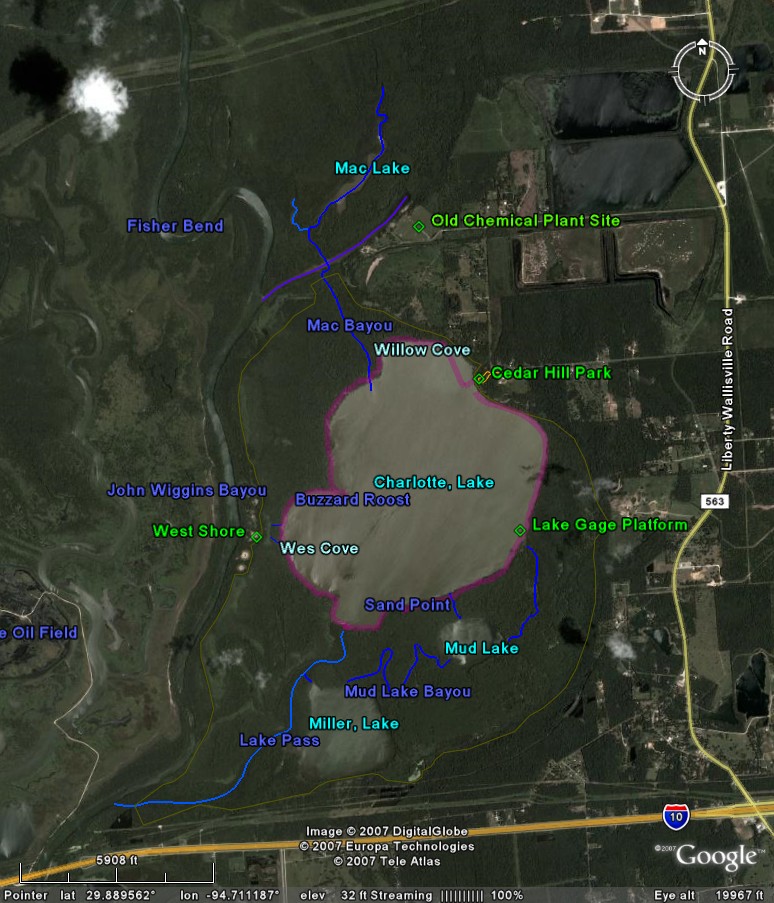
March 18, 2007 - Lake Charlotte Survey 1
Gage Level: 9.2 Feet
Weather Summary for the Day:
57 to 78 degrees Fahrenheit
53% to 91% Humidity
SSE Wind 10 mph gusting to 12 mph
The objective this trip was to establish the level of the lake bottom in several
transects. What really happened was that the wind was very high, making for high
waves, so much of the outing was spent in the shelter of the cypress verge. Lake
level was about 9.2 feet. Did manage to record bottom height at 9 locations along
the northwest quadrant of the lake, including one measurement a short distance away
from the verge where Buzzard Roost provided shelter from wind and waves. Lowest
point measured was 5.7 feet, corresponding to a depth of 3.5 feet this day. This
puts the waves into perspective... at least near the verge, capsizing would be into
waist-deep water. Will attempt mid-lake bottom profiles sometime when the wind isn't
so strong.
March 25, 2007 - Lake Charlotte Survey 2
Gage Level: 9 Feet
Weather Summary for the Day:
68 to 80 degrees Fahrenheit
68% to 95% Humidity
SSE Wind 10 mph gusting to 10 mph
This trip was my first successful attempt at depth surveying. Lake Level at 9 feet.
Due to high winds I had to stay mostly within the treeline. Later subtracted lake
depths from lake gage level to get the elevation of the lake bottom per the gage
(at lowest it is about 5 feet). This became the foundation for development of a
contour map of the lake.
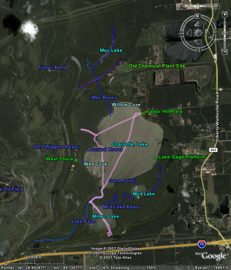
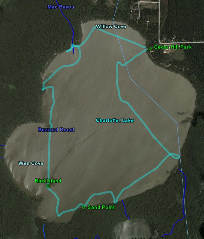
April 8, 2007 - Lake Charlotte & Miller Lake Survey
Gage Level: 10.7 Feet
Weather Summary for the Day:
38 to 40 degrees Fahrenheit
95% to 98% Humidity
N Wind 3 mph gusting to 4 mph

This was a very productive trip. Proceed from Cedar Park to Lake Pass, and verified
that the channel to Miller Lake existed as I had previously suspected. Traversed
to South Shore of Miller Lake and discovered extensive high ground with oak trees
easily accessible from the lake. Tree Swallows were skimming the lakes throughout,
sometimes approaching to within a foot of my head and generally skimming within
a body length of the water's surface. As I returned to Lake Charlotte a large owl
landed in a tree next to me and just sat and watched as I passed, quietly whooting.
Stopped at Bird Island and verified the presence of high ground near the southwest
corner of the stand of trees marking the island. Finally headed north, skirted the
shore of Buzzard Roost island, and explored far to the west along the apparent Old
Channel, as well as a short distance along the intersecting Cross Channel. Acquired
scattered depth measurements throughout the course of this trip. Finally darted
across the lake to Cedar Park and headed home. Lake level was near 10.72 feet (very
high), wind was generally very light. Temperature near forty. Nice trip, typically
cruising at 4-5 mph when covering open water.
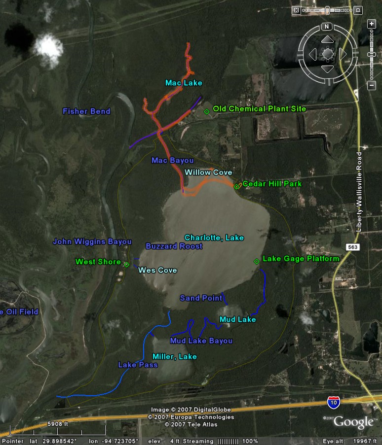
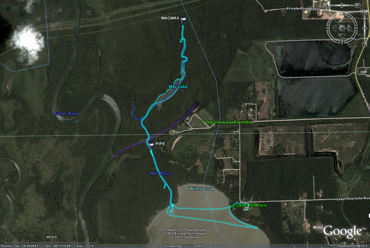
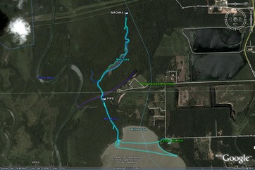
April 15, 2007 - Mac Bayou, Mac Lake (Survey), & Barge Canal
Gage Level: 11.4 Feet
Weather Summary for the Day:
44 to 82 degrees Fahrenheit
28% to 88% Humidity
NNW Wind 5 mph gusting to 6 mph
This was a great trip, predominantly revolving around the exploration of Mac Bayou
and Mac Lake. Lake Charlotte was at a very high level level of 11.4 feet today.
I proceeded from the put-in directly to Mac Bayou, turning north to follow the bayou.
Current was moderately high such that I was only able to manage about 1.5 mph upstream
against it. Natural levees to either side of the bayou were largely submerged. Reached
the barge channel and headed up it (eastish) towards the old chemical plant, noticing
high ground on the south side, while the north side seemed fully submerged. At a
point about halfway along the chemical plant site multiple alligators (at least
4) dove into the water ahead of me, about 0.2 mile from the end of channel; a couple
of the alligators were extraordinarily large, on the order of 16 feet and similar
in scale to my canoe. They were not shy, and sat on the surface obstructing the
last portion of the channel such that I felt it wisest to turn around and leave
it to them. I proceeded back to Mac bayou and followed it to the north of where
it entered the barge channel. Mac Bayou/Lake are wonderful, easily the nicest area
I have yet encountered around Lake Charlotte. It feels like a genuine wilderness,
with wide channels and large and impressive cypress trees along the banks. Further
upstream it opened into Mac Lake, a lake which is large enough to feel spacious
yet not so large that wind-driven waves are likely to be a problem; generally well
sheltered. I followed north past the lake and followed Mac bayou, finding the water
amazingly clear as I got further upstream, until the trees began to close in and
I reversed and retraced my route back down the bayou, pausing to explore the side
bayou which enters Mac Bayou about 0.2 miles north of the barge channel - this bayou
was comfortably wide, even opening into a small lake, but only good for about a
quarter of a mile before the channel began to blend into the trees. Returned to
the barge channel, then back into the southern segment of Mac Bayou, this time with
the assistance of the current I was making 5-6 mph as I followed it back to Lake
Charlotte; note that at about a tenth of a mile south of the barge channel there
is an old pipeline crossing and perhaps the remnants of a bridge, and by the appearance
of the standing waves there seem to be some submerged obstructions here, and the
bayou is a bit narrower as well - potentially worthy of caution when approaching.
Reached Lake Charlotte uneventfully, crossing over the delta and returning to the
put-in at Cedar Hill Park. In the course of this trip I measured the depth at many
locations in Mac Lake, and found it generally between 6 and 7 feet deep, while a
couple of places I later measured in Lake Charlotte were about 6.5 feet deep. Not
sure what the drop-off is between the barge channel and Lake Charlotte, but it must
be at least a couple of feet to support the observed current.
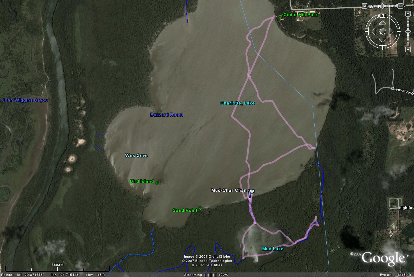
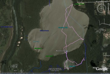
April 22, 2007 - Mud Lake East Channel (Exploration), Mud Lake, Miller
Lake
Gage Level: 10.7 Feet
Weather Summary for the Day:
67 to 86 degrees Fahrenheit
47% to 96% Humidity
SSE Wind 10 mph gusting to 12 mph
On this trip I established that a contiguous channel connects between a point
on the east edge of Lake Charlotte, just to the SE of the Lake Gage, to the the
main eastern channel feeding into Mud Lake. The central portion of this channel
is occupied by a dense marsh and was not directly traversed as it struck me as prime
alligator nesting territory, however I entered this marsh from both the Lake Charlotte
side and the Mud Lake side and could see that there was open water connecting the
two points. I also established that a deep channel connects directly between
the southeast shore of Lake Charlotte and Mud Lake, though you have to get a ways
back into the cypress marsh to clearly discern it. I explored a couple of
regions of the cypress marsh south of Mud Lake in some depth, then proceeded through
Mud Lake Bayou to Miller Lake and finally back through Lake Pass via the main channel
at the northwest corner of Miller Lake, and finally directly back to Cedar Hill
park. Extremely windy and big waves on Lake Charlotte.
May 13, 2007 - Mac Bayou & Mac Lake
Gage Level: 11.9 Feet
Weather Summary for the Day:
69 to 98 degrees Fahrenheit
31% to 94% Humidity
S Wind 4 mph gusting to 7 mph
Lake Gage was at 11.9 feet, the highest I've yet seen it. I paddled up Mac Bayou
- very strong current, progress upstream was probably 1 mph at best against it.
Note - tricky currents at and above the old pipeline crossing due to sharp turn
as water enters from the Barge Channel were a bit tricky at the high flow rate,
very chaotic/turbulent; a boat with a distinct keel might have been overturned.
From the Barge Channel I proceeded up through Mac Lake to the upper realm of Mac
bayou, stopping when further progress would have meant a bit too much intimacy with
the spider-infested overhanging bushes and trees. Returned southwards, traversing
Mac Bayou between the Barge Channel and Lake Charlotte at 6-6.5 mph (fast transit),
then messed-about in the cypress verge at the northwest corner of the lake prior
to returning to Cedar Hill Park and heading home.
June 3, 2007 - Lake Charlotte
Gage Level: 10 Feet
Weather Summary for the Day:
74 to 94 degrees Fahrenheit
48% to 95% Humidity
S Wind 10 mph gusting to 10 mph

Circled Lake Charlotte, simply following along the shore. On this outing I
was mostly just out for the exercise, however I noted that Sand Point seems to be
a popular hang-out with the alligators (noted some smaller ones back in the marsh
there), and there was a big splash behind me as I traversed behind Buzzard Roost
Island as a largish gator was startled by my passing.
September 24, 2007 - Mac Bayou, Mac Lake, Barge Canal, Trinity River
Gage Level: 9.2 Feet
Weather Summary for the Day:
72 to 91 degrees Fahrenheit
42% to 96% Humidity
ESE Wind 6 mph gusting to 6 mph
The lake gage was at about 9.2 feet; making this among shallowest I have seen (about
4 feet deep at the center). Due to the steep drop-off at Cedar Hill Park, there
was no difficulty in launching into deep water, and the only place I where I found
it troublesomely shallow was at the Mac Bayou delta (which I decided to land on
briefly � a bit muddy). I traveled up Mac Bayou, finding shores about 2-3 feet high,
with no detectable current. Mac Bayou was particularly pleasant under these conditions,
a shady corridor with greenish water � very peaceful except for a couple of motor
boats which came exploring off the Trinity (polite and well behaved). I encountered
a few alligators near where Mac Bayou intersects the barge canal, and then further
up near Mac Lake I had a small (4-5 feet) alligator swim up parallel to my canoe
under water (water was clear enough to see it down to a couple of feet) about ten
feet away, then it surfaced and saw me and submerged out of sight. Fish were jumping
all over the place � I had one leap over the canoe, missing my nose by a couple
of inches. Later I followed the barge channel to the Trinity for the first time
(something I would never do when the water is high enough to create a current in
Mac Bayou) where I simply went out into the center of the river and looped back
into the barge channel � even at this relatively low level I found the Trinity worrisomely
turbulent, particularly near where it passed the barge channel, but I have the problem
of a long canoe which maneuvers poorly. I next followed the barge canal to its eastern
end by the remains of the old chemical plant (another alligator cruising back and
forth there, not troublesome), then headed home. Overall a very nice trip and I
now see advantage to visiting the lake at lower water levels. I would not hesitate
to go out when the gage was at 8 feet, but 7 feet is still likely the minimum for
useful water.
November 4, 2007 - Clockwise shoreline survey
Gage Level: 6.8 Feet
Weather Summary for the Day:
55 to 85 degrees Fahrenheit
35% to 98% Humidity
S Wind 6 mph gusting to 6 mph
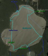
On this trip the lake gage was at 6.8 feet, the lowest I have yet seen (the gage
equipment was malfunctioning, so I took that measurement visually from the side
of the gage). Launching the canoe was a little more troublesome than usual, as the
waterline at Cedar Hill park was below the usual steep drop-off, so that it was
shallower and muddier than usual. Had to paddle several hundred feet from shore
until the water became deep enough to stroke without hitting the bottom. Proceeded
to the lake gage, checked the level (quite shallow near the gage), and noted a bit
of high ground visible at the edge of the marsh east of the gage. The high ground
there was probably a couple of feet above the water level, but the intervening water
was too shallow to approach and land. I returned to deeper water and headed west
along the shore. I attempted to locate the Mud Lake channel, but could not discern
it with the water this shallow. Continued west to Sand Point, where I found high
ground (at least gage level 8.5 or better) and landed, encountering relatively deep
water up to the shore, then hard sandy ground with scattered shells and a bit of
charcoal (the best place to land I've yet found). Incidentally, throughout this
trip the Mac Bayou delta to the north was very prominant due to the wide expanse
of exposed sand. I cruised through the outlet bay to Lake Pass (shallow), then swung
along the west shore of Bird Island (lot's of birds, including plentiful spoonbils
and cormorants, plus some I didn't recognise), noting that the high ground of the
island was mostly about a foot above the water, focused on a strip at the western
edge of the trees, and is a typical shell midden (though oddly the shells here mostly
all had a hole punched through them). Moved on to the north and skirtedt the shore
of Buzzard Roost island (very high), observing a small (3-4 feet) alligator near
the southeast shore. Continued northwards, pulling a bit into the marsh along the
west shore, finding it very shallow and with dry ground visible further west, and
cypress knees standing 6-7 feet high all about. Next I proceeded to the Mac Bayou
delta, today a broad span of high sandy (muddy) ground with lot's of birds resting
or fishing near it. I paddled through the shallows to the east of the delta and
finally encountered a deep channel connecting the lake to the bayou right along
the edge of the trees to the east of the bayou's mouth. While paddling into the
bayou I was surprised to find that the water was flowing north out of the lake through
the bayou with a pretty distinct current -- apparently at the current low level
the Trinity is very affected by the tides even this far upstream, and the tide was
going out out. I briefly explored a shallow channel between the delta and the treeline
west of the bayou mouth, then retraced my path eastward and returned to the park.
Based upon this experience, the 6.8 feet gage level is near the lowest navigable
level (water near the center of the lake would have been only a couple of feet deep
at best). Mac Bayou was still navigable, but generally my paddle was stroking the
lake bottom within a few hundred feet (or yards even) of the shoreline about much
of the lake. Six inches less water would have made this a much more troublesome
outing, so the 6 foot gage level is arguably the absolute minimum for access and
navigablility.
December 16, 2007 - Island survey
Gage Level: 7.2 Feet
Weather Summary for the Day:
34 to 57 degrees Fahrenheit
32% to 84% Humidity
NNW Wind 7.6 mph gusting to 7.6 mph
Gage Height was 7.2 feet, temperature near 50 degrees. The focus of this trip was
to explore the islands in depth, landing upon them and strolling from end to end
of the solid ground to determine the extent. Landed first on Sand Point, finding
that for all practical purposes the useful high ground is along the northernmost
portion, which would make a decent camp or picnic site. Moved on to Bird Island,
which consists of long north-south oriented bar of shell midden along the western
edge of the stand of trees; useful to get out of the water for a bit, perhaps even
a cramped picnic, but not big enough for anything serious. Finally moved on to Buzzard
Roost, which is a really substantial piece of very high ground - space enough for
several small homes if they didn't mind being close together. Would be a great place
to camp if not for being covered by vines and bushes. Both Buzzard Roost and Sand
Point provide ideal alligator nurseries when the weather is warmer, which further
limits their utility. Still, one benefit of the low water level lately is an opportunity
to get out of the canoe from time to time.
December 23, 2007 - Island survey
Gage Level: 8.2 Feet
Weather Summary for the Day:
31 to 59 degrees Fahrenheit
26% to 84% Humidity
S Wind 4 mph gusting to 17 mph
Gage level about 8.2 feet (falling), temperature in the fifties. The major focus
of this trip was a northward push up Mac Bayou, reaching about 1000 feet further
up the channel than I had previously managed. I began by heading to the Mac Delta,
where I landed and wandered the (somewhat muddy) shoreline with the GPS to get a
measurement of its scale. Next I headed up Mac Bayou, pausing about 1/4 mile up
from the delta to explore a small channel which extended to the southwest for a
couple of hundred feet. A brief exploration on foot found nothing of interest. Back
in the canoe, I continued to head northwards up Mac Bayou, where the current was
flowing out of Lake Charlotte at about 2 mph. In the upper section of the bayou,
north of the barge canal, there was also a current flowing into the canal (southwards)
of 1-2 mph. I paddled through Mac Lake, hugging the north shore and noting that
there was extensive solid ground just a short distance into the treeline, where
the ground was generally flat and only about 6 inches above the water level - fairly
consistent throughout the Mac Bayou region north of the Barge Canal. Upon reaching
the northern terminus of the lake, where the bayou continues to the east and then
loops counter-clockwise to the west before turning north, I encounted a group of
about 5 beavers swimming and eating near the mouth of the bayou. Some months back
I'd encountered an older paddler who wondered whether I'd seen the "beaver dam"
up Mac Bayou (I hadn't), and now I wonder whether the beaver dam is what the bayou
is looping around at this point (rather obvious from above). After watching the
beavers for awhile I headed northwards up the bayou, eventually passing well beyond
(about 1000 feet north) where I'd managed to reach in the past, pushing my way through
some tight spots until I encounterd a blockage (fallen tree and accessories) which
seemed more trouble to get past than I felt like dealing with. Here I took an extended
break, noting an apparent clearing visible through the trees to the northwest (presumably
the pipeline (?) clearing visible from above), then headed back south. While heading
southwards I realized that the water was flowing northwards, then found the channel
closing in around me, and realized that I had somehow left the main channel. Following
a few minutes of disorientation(in spite of the GPS) and concern that I might have
to spend the night out here, I pulled out my compass for reassurance and decided
to follow the current, which after a bit led me back to the main channel (sigh of
relief), and I headed back to Lake Charlotte without further incident. Wind
at 1 pm was low and out of the north (~4 mph), but reversed and turned to come out
of the south around 4:30, making for a slightly choppy crossing.
December 30, 2007 - Mud Lake
Gage Level: 6.7 Feet
Weather Summary for the Day:
40 to 71 degrees Fahrenheit
28% to 93% Humidity
WNW Wind 3 mph gusting to 5 mph
Gage Height was 6.7 feet. The focus of this trip was the first low water level visit
to Mud Lake, and an attempt to complete the link between Mud Lake's east channel
and Lake Charlotte to the north (unsuccessful due to the low water level). I proceed
first to the lake gage, where I recorded the level, then attempted to land on the
high ground to the east of the gage. The water was just a bit too shallow to permit
this, and the canoe grounded in mud about 20 feet from the shore. The height of
the ground seemed at least 4 feet above the current water level. Next I moved on
to the Mud Lake channel, expecting not to be able to find it as happened last time
the water level was this low. After a bit of exploration near the divot in the treeline
where I knew the channel to have been in the past, a clear and relatively deep channel
became obvious towards the eastern end of the divot. Not only was the channel clear
and navigable, but a moderate current was flowing out of it from Mud Lake. The water
was fairly clear, in contrast to what you might expect from the name of it's source.
I proceeded south through the channel, finding a couple of places where the current
was strong enough to create rippling ripples, and after a bit arrived in Mud Lake.
The water in Mud Lake was relatively clear and shallow; clear enough to clearly
see the bottom, but not so shallow as to impede navigation, even though the paddle
dipped into mud with each stroke. I headed to the eastern end of the lake, noting
extensive water plants covering the bottom on the eastern and southerly parts of
the lake. I entered the east channel and headed upstream, hoping to reach the marsh
to the northeast of the lake, and then take the north channel from the marsh back
to Lake Charlotte near the Lake Gage. I found myself blocked by fallen trees and
brush covering the channel, then attempted to head north on a side channel which
quickly dissipated into the trees. A subsequent review of my track in Google Earth
suggested that I was not far from the marsh, so with higher water this route should
be feasible. Noting that very little current was discernible in the channel, I returned
to Mud Lake and headed west to where Mud Lake Bayou headed west towards miller lake.
The channel was very wide, but a distinct current was flowing into Mud Lake, which
I presume is the source of the flow in the north channel. I returned to Lake Charlotte
through the north channel, and headed home.